Research Topics
Modelling
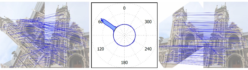
3D reconstruction pipelines take collections of images and produce 3D models of the world. While this task has become almost routine, there are many steps in the pipeline, and many areas that can still be explored and improved. The models produced find a wide variety of applications, including augmented reality, digital culture and heritage, medical imaging and surgery, and robotics One of the main areas I am exploring is the exploitation of feature scale and orientation in this context. Most structure-from-motion pipelines are based on point features, but the most successful feature detectors (such as SIFT and ORB) estimate the size and orientation of the features as well as their location. This additional information is often discarded, but can be used to identify unreliable feature correspondences between images, or to accelerate RANSAC-based camera pose estimation. Another area of interest is exploiting parallel computing to handle large data sets for vision processing. 3D reconstruction methods scale up to several thousand images, but larger scenes are often processed in parts. Even on smaller data sets, there is a lot of processing to be done, and exploiting parallel hardware can make significant speed increases. More...
Understanding

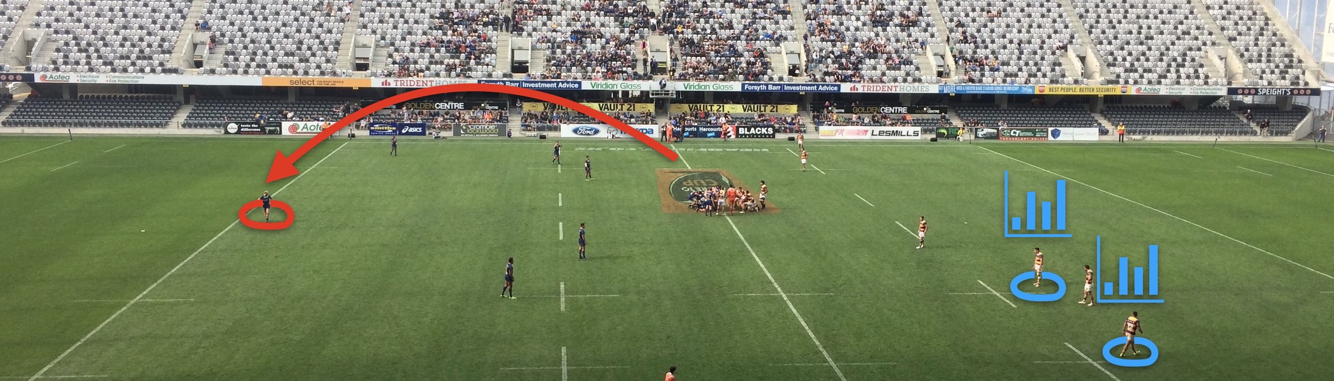
Situated Visualisation of data from geographic information systems (GIS) is exposed to a set of problems, such as limited visibility, legibility, information clutter and the limited understanding of spatial relationships. In this work, we address the challenges of visibility, information clutter and understanding of spatial relationships with a set of dynamic Situated Visualization techniques that address the special needs of Situated Visualization of GIS data in particular for street-view-like perspectives as used for many navigation applications. The proposed techniques use GIS data as input for providing dynamic annotation placement, dynamic label alignment and occlusion culling. More...
Visualisation
Situated Visualisation of data from geographic information systems (GIS) is exposed to a set of problems, such as limited visibility, legibility, information clutter and the limited understanding of spatial relationships. In this work, we address the challenges of visibility, information clutter and understanding of spatial relationships with a set of dynamic Situated Visualization techniques that address the special needs of Situated Visualization of GIS data in particular for street-view-like perspectives as used for many navigation applications. The proposed techniques use GIS data as input for providing dynamic annotation placement, dynamic label alignment and occlusion culling. More...
Interaction
Situated Visualisation of data from geographic information systems (GIS) is exposed to a set of problems, such as limited visibility, legibility, information clutter and the limited understanding of spatial relationships. In this work, we address the challenges of visibility, information clutter and understanding of spatial relationships with a set of dynamic Situated Visualization techniques that address the special needs of Situated Visualization of GIS data in particular for street-view-like perspectives as used for many navigation applications. The proposed techniques use GIS data as input for providing dynamic annotation placement, dynamic label alignment and occlusion culling. More...